
The Canadian Rocky Mountains make Calgary and its surrounding areas an ideal destination for outdoor enthusiasts. Hiking is a fantastic and affordable way to enjoy the local nature. To learn about the best hiking trails and what to expect along each route, read on. More on calgary-name.com.
Bow River Pathway and Prince Island Park
Within Calgary, there are several hiking trails, but this 48-kilometer route is one of the most popular for walking, running, and cycling. The path, which mostly consists of paved flat roads, is accessible to all visitors.
Walking along the Bow River through the city center, you’ll see people fishing or kayaking in the river, stunning views of the city, and the iconic bright red Peace Bridge. At the end of the route, be sure to visit Prince Island Park.
Grassi Lakes Trail
The Upper and Lower Grassi Lakes are located at an elevation of 1525 meters in the southern Canadian Rockies, in the town of Canmore, which is close to Calgary. The lakes are fed by the Spray Lakes Reservoir. This area is part of the provincial park, “Northern Centre Canmore.”
The trail is 4.3 kilometers long. This easy, scenic hike is suitable for most hikers, though it does involve climbing stairs. Once at the top, you’ll be rewarded with breathtaking views of Ha Ling Peak.
It is important to note that this area may be closed due to adverse weather conditions.
Grotto Canyon
Opposite the town of Canmore, you’ll find the provincial recreation area Grotto Mountain, home to Grotto Canyon. The 4-kilometer hike to this canyon attracts tourists because of the massive rock formations along the way. This is a very popular spot for birdwatching, hiking, and snowshoeing.
Local climbers can often be spotted scaling the vertical rock faces. The trail also includes a rocky path, and at the end of the route, you’ll find a waterfall where you can relax or even enjoy a picnic.
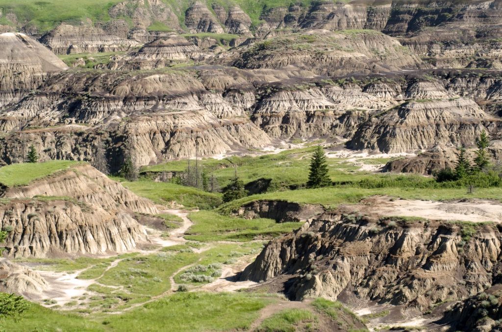
Horseshoe Canyon
Horseshoe Canyon is a marshy area surrounded by prairies. Located in Kneehill County, it is less than 1.5 hours from Calgary. The canyon gets its name from the shape of the two gullies that form a horseshoe.
The trail is 2.9 kilometers long. This walk through a desert-like landscape with striped rocky formations and plateaus is well worth completing with a trip to the “Dinosaur” provincial park, one of the largest dinosaur fossil sites in the world. Interestingly, in 2020, a man named Nathan Grushkin discovered a 69-million-year-old dinosaur fossil in the canyon.
Troll Falls
Troll Falls is a fantastic option for family outings and is located just over an hour from Calgary in the Kananaskis area.
The trail is only 3.4 kilometers long, so it can be combined with other hikes in Kananaskis. In the winter, it’s advisable to wear microspikes for safety.
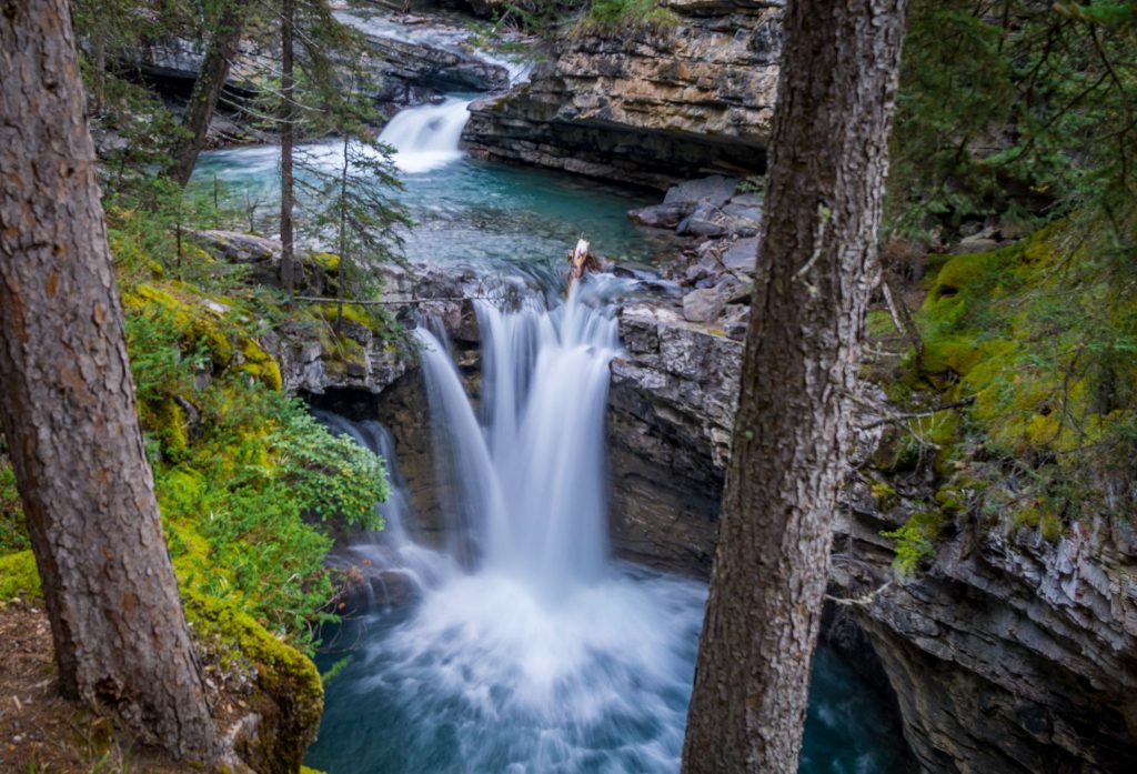
Johnston Canyon
Johnston Canyon in Banff National Park is another great hiking option. This unique trail consists of a series of metal bridges along the cliffs, which lead to a breathtaking canyon without requiring a climb. The trail is 5 kilometers long.
Between narrow stone ravines, you’ll find waterfalls. There are several variations of this hike. The short trail takes hikers directly to the lower waterfalls, while the longer one extends all the way from the upper waterfalls to the “Ink Pots” – a natural phenomenon where the water appears to be stained with ink.
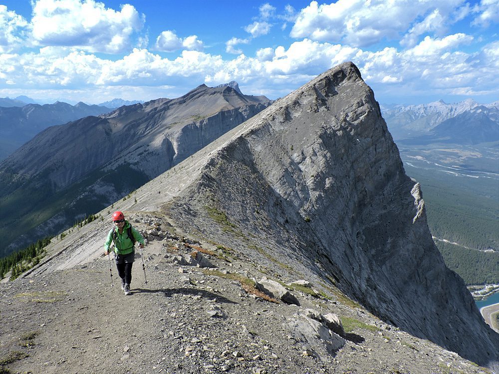
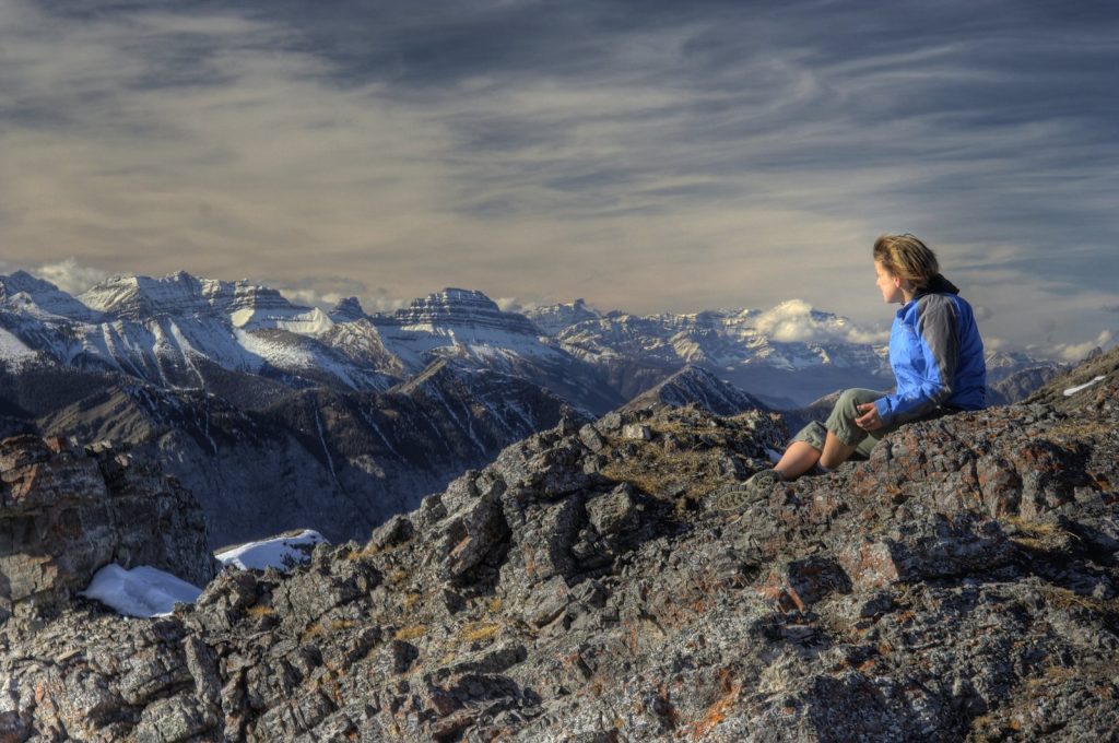
Ha Ling Peak
Located south of the town of Canmore, Ha Ling Peak stands at 2,407 meters. Reaching the summit requires a 7.2-kilometer hike.
This challenging hike is rewarded with panoramic views of the Bow Valley and nearby mountains, such as East End Rundle and Lady MacDonald.
The mountain’s name has been the subject of much debate. Initially, locals referred to it as the “Beehive.” In 1896, Ha Ling, a Chinese cook for the Canadian Pacific Railway, bet $50 that he could reach the summit and plant a flag there in under 10 hours. He began the climb at 7:00 a.m. and returned in time for lunch. Since no one believed his story, he took a group to the summit and planted a much larger flag next to the original, visible to the naked eye from Canmore. The peak was later renamed Ha Ling Peak in 1997, as the term “Chinaman” was considered derogatory.
The trail is sometimes closed due to adverse weather conditions.
Ptarmigan Cirque Basin
This moderate hike to a basin in the mountains created by glacial erosion is located in the Kananaskis area.
The 3.5-kilometer trail is popular with locals, offering views of tiny waterfalls in the cliffs and numerous forested areas. This trail is especially popular in the fall when the larch trees turn orange and bright yellow against the backdrop of the mountains.
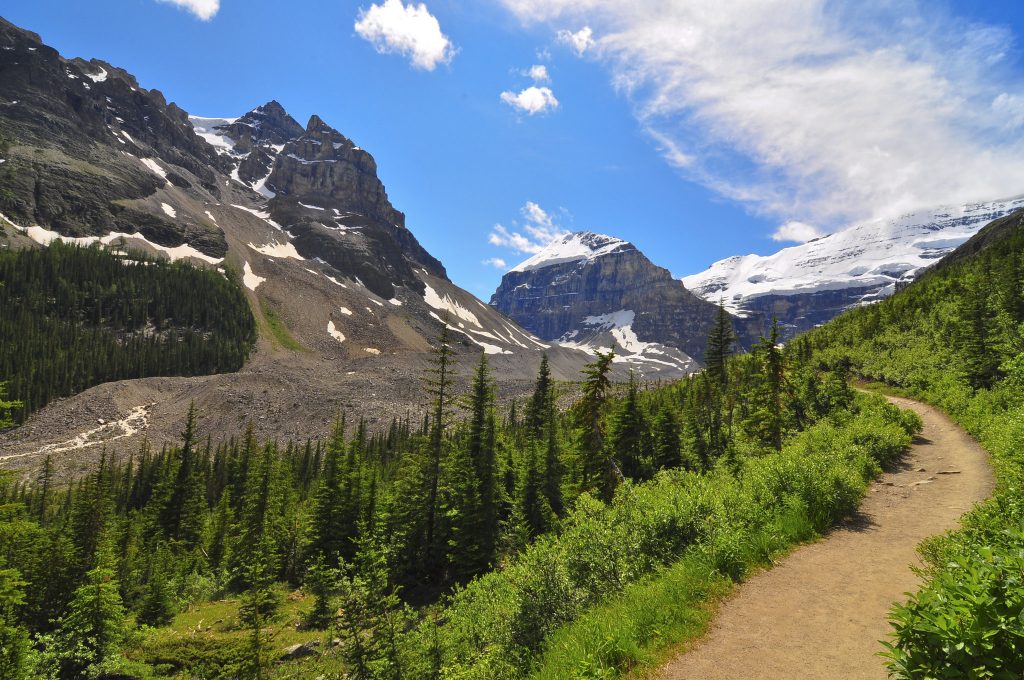
Six Glaciers Trail
In Banff National Park, specifically at Lake Louise, there is a 14.6-kilometer hiking trail. It is a challenging route, with rocky, winding paths that lead visitors from the busy shores of Lake Louise to more secluded spots deep within the Rocky Mountains.
Here, you’ll encounter stunning glaciers, rocky mountain peaks, and scenic desert-like passes. Be sure to stop at Abbots Pass to capture the breathtaking views.
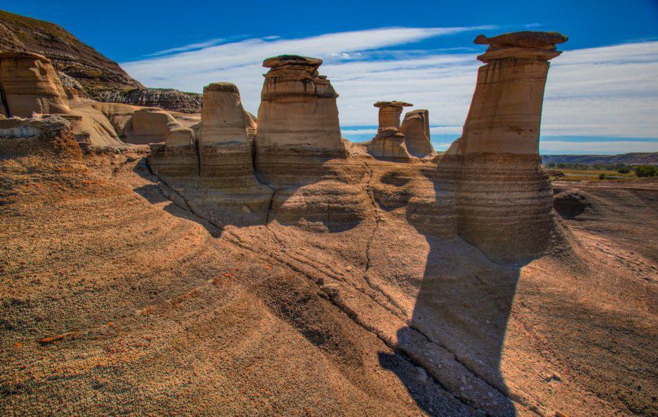
Hu Do Trail
There are several trails in Alberta called the Hu Do Trail, but the one in question is located in the Writing-On-Stone provincial park. It is 5.6 kilometers long.
The trail leads through bizarre rock formations. Unlike the evergreen alpine landscapes, the terrain in this area of Alberta is dry and unique.
East End of Rundle (EEOR)
In the town of Canmore, the famous East End of Rundle trail is 5.6 kilometers long. The trail isn’t overly difficult, but at times you’ll need to use your hands to climb. From the summit, you’ll be treated to views of the Bow Valley, Ha Ling Peak, and surrounding mountains.
The mountain, which stands at 2,590 meters, consists of sedimentary rock formed during the Precambrian and Jurassic periods.
Mount Yamnuska
Mount Yamnuska, also known as Mount John Laurie, is located near Calgary, in Bow Valley Provincial Park. The mountain stands at 2,240 meters.
Yamnuska translates to “stone wall.” The 10.1-kilometer hike to the mountain is a true adrenaline rush. It is best suited for well-prepared individuals and climbers. The trail is known as the “gateway to the Canadian Rockies” and leads through evergreen forests, steep rocky slopes, and a rocky ledge that must be carefully crossed while holding onto a chain.
Burjo Lake and Harvey Pass
This is another route in Banff National Park, stretching 17.5 kilometers. The full-day challenging hike offers one of the best landscapes in the park, including a quiet, secluded lake and panoramic views.
Along the hike, you may encounter wildlife. It’s worth taking a break near Burjo Lake and Harvey Pass. This popular spot for birdwatching and camping is perfect for a rest. From here, you can either return or ascend Burjo Mountain, which rises 2,931 meters. Like other mountains in Banff Park, it consists of sedimentary rock.