

Park · Calgary · ⭐ 9.5/10 · 5128 reviews · updated: 2026-08-04 15:53:36
Address: 6465 14 St NW, Calgary, AB T3K 2P6, Canada
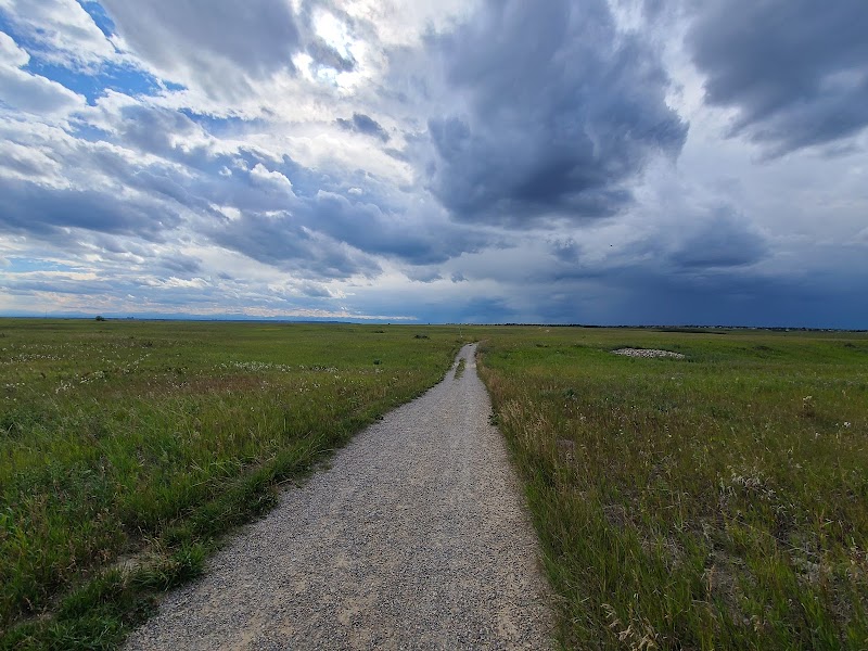
Nose Hill Park — prairie grassland above the rooftops
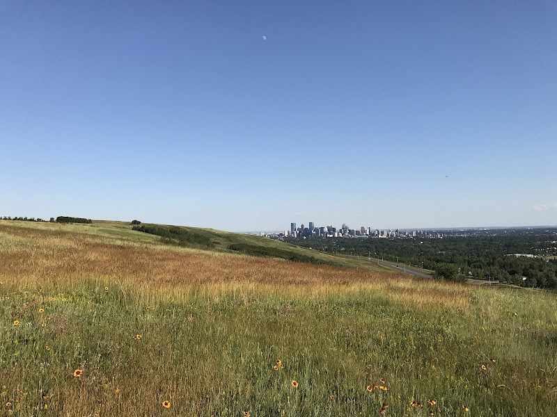
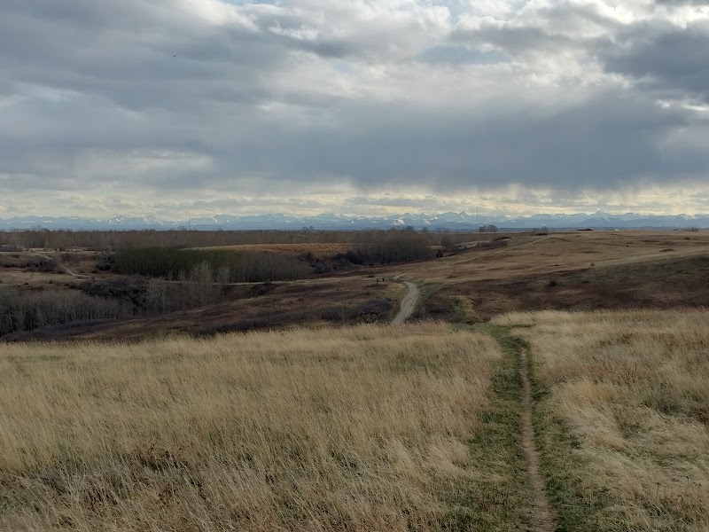
A broad, treeless hill rises over northwest Calgary and holds eleven square kilometres of native prairie that was never broken by a plough. Climb ten minutes from any edge and the city simply falls away: downtown towers to the south, the Bow valley below them, the plains running east, and on a clear day the Rocky Mountains laid out along the whole western horizon.
Highlights
- Siksikaitsitapi Medicine Wheel — a stone circle laid in 2015 by members of the Blackfoot Confederacy, representing its four nations.
- Rough fescue grassland — one of the last significant remnants of this ecosystem left on the Canadian prairies, with over 60 native plant species.
- Turtle Rock — a turtle-shaped quartzite erratic on the upper slope, and one of the finest viewpoints over the city.
- The Rubbing Stone — a boulder worn smooth by generations of bison scratching off their winter coats.
- Porcupine Valley and Many Owls Valley — sheltered coulees of trembling aspen and willow that hold most of the hill’s wildlife.
- The summit plateau — an unbroken panorama at roughly 1,200 metres, plains on one side, mountains on the other.
What you’ll find
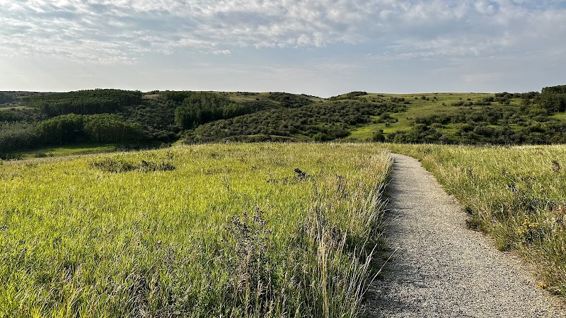
This is a natural environment park, deliberately left rough. There are no manicured lawns, no lights and no concessions — underfoot it is grass, gravel and worn dirt, and the hill is largely left to look after itself.
- Dirt and gravel trails across the plateau, with a few paved sections
- Parking lots and community entrances on every side of the hill
- Washrooms at two of the main entrances
- Off-leash areas covering roughly a third of the park
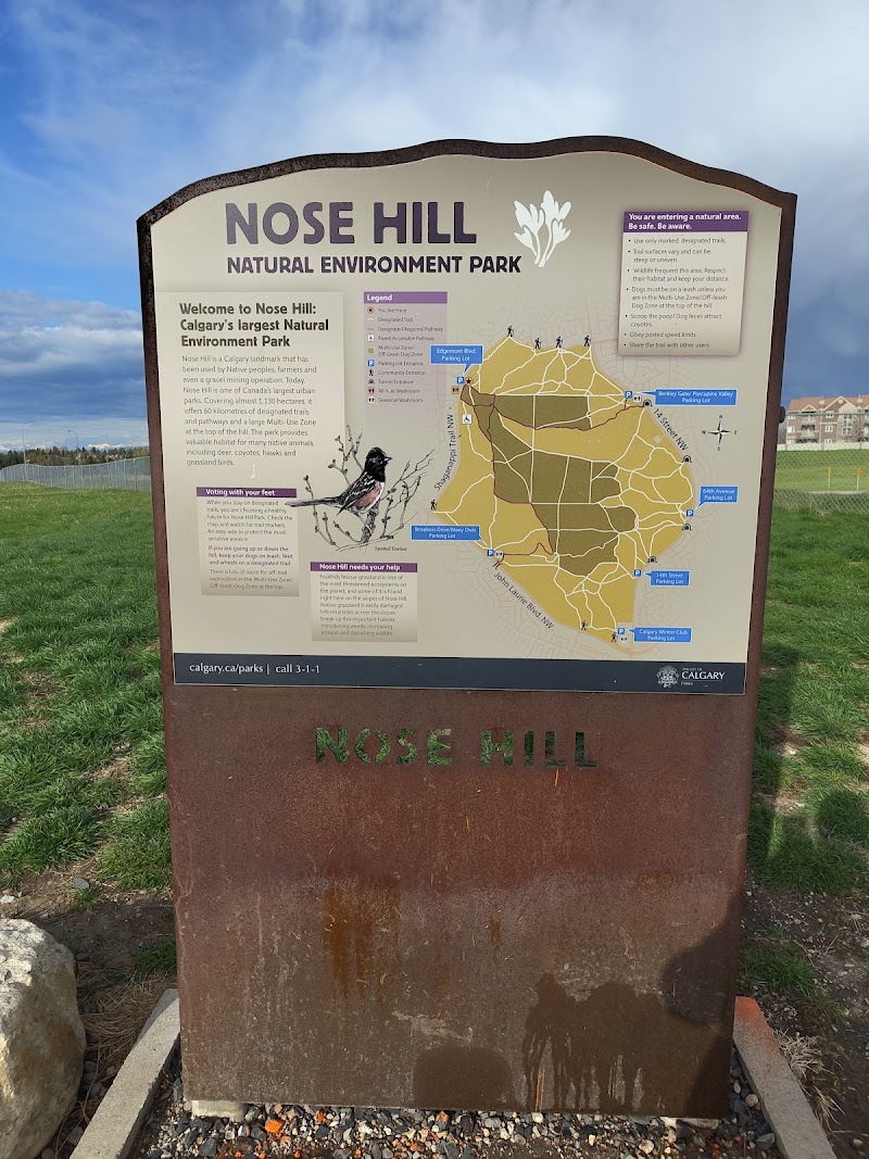
- Interpretive signage and an augmented-reality Indigenous heritage trail
Things to do — and who it’s for
- Photographers — sunrise over the eastern plains and sunset behind the mountain skyline, both from open ground.
- Dog owners — some of the largest off-leash terrain in the city, though the designated zones take a walk to reach.
- Trail runners — long steady climbs and rolling grassland loops with no traffic and no crossings.
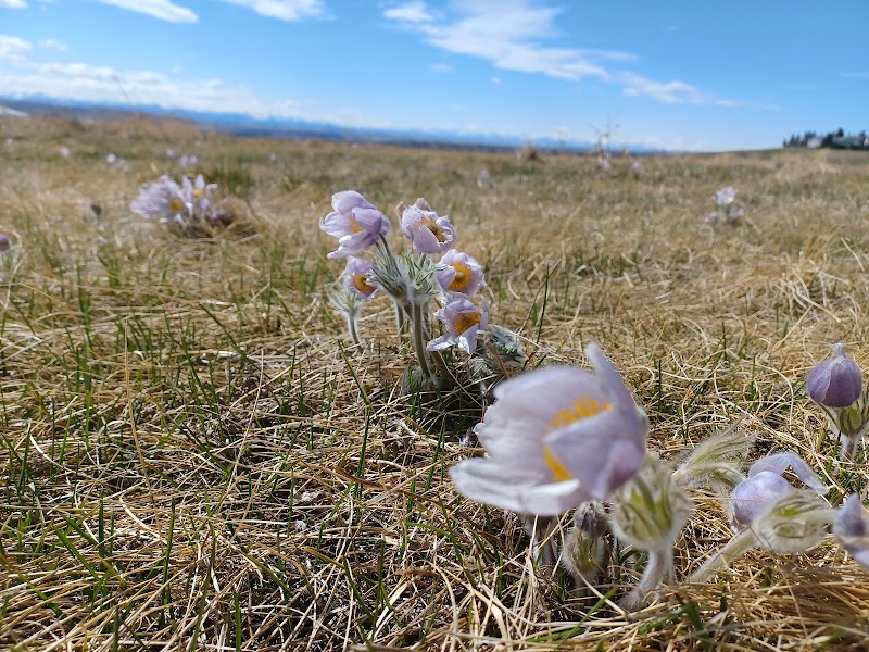
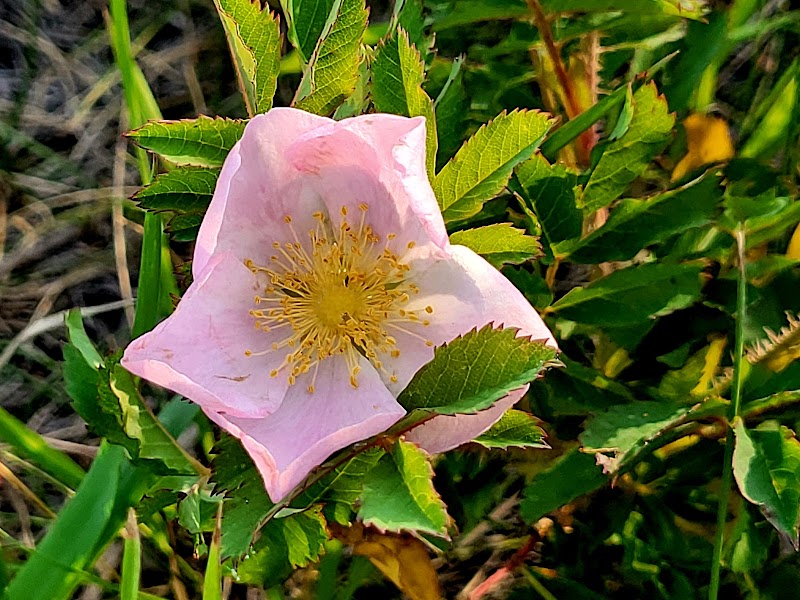
- Families and plant lovers — prairie crocus in April, golden bean and bedstraw later, on trails gentle enough for children.
- History-minded visitors — tipi rings, cairns and stone circles still lying where they were built.
- City escapers — twenty minutes from downtown and completely out of earshot of it.
Getting there & practical
Twelve communities ring the hill: Brentwood, Varsity and Dalhousie to the southwest, Edgemont and MacEwan Glen along the north, Huntington Hills and Thorncliffe on the east. Parking lots sit on every side, city buses stop at the community edges, and from the Red Line CTrain at Brentwood or Dalhousie it is roughly a twenty-minute walk to the nearest gate. Entry and parking are free, and the park is open from early morning until late evening. A short loop to a viewpoint takes about an hour; crossing the hill from one side to the other takes three, and there is nowhere to buy water along the way.
When to visit
April and May bring prairie crocus up through last year’s dead grass and the first green on the fescue. Summer evenings are the classic time — long northern light, a breeze off the plateau, and the city coming on below. Autumn turns the coulee aspens yellow and the grassland to bronze, and the light stays low and warm all afternoon. Winter is stark and often fiercely windswept, so dress in layers, because nothing up here breaks the wind — but the air is at its clearest and the mountains at their sharpest.
Good to know
The hill is an ancient river terrace. Its rounded quartzite boulders, some 500 million years old, were carried out of the mountains and dropped here by rivers long before the ice came; the ice sheets then left glacial till across the top, and Glacial Lake Calgary laid silts and clays down the flanks around 16,500 years ago. Blackfoot peoples used the summit for bison hunts, for ceremony and vision quests, and as a lookout over both the plains and the weather. Archaeologists have recorded 45 sites on the hill, among them tipi rings, campsites, stone cairns and a kill site. The City set the land aside as parkland in 1980.
Visitor tips
- Coyotes and deer live here year-round — keep your distance, keep dogs close, and never feed them.
- There is almost no shade or shelter on the plateau; carry water, sun protection and a windproof layer whatever the forecast says.
- Stay on the trails and off the stone circles and cairns — these are sacred sites and legally protected.
Questions & answers
How big is it? About 1,129 hectares, which makes it the fourth-largest urban park in Canada and one of the largest in North America.
Is there an entrance fee? No. The park and all of its parking lots are free, and it is open daily.
Can dogs run off leash? Only in the designated areas, which cover about a third of the park; from most entrances you walk on leash until you reach one.
Can you see the Rocky Mountains? Yes, on clear days the whole western horizon is visible from the plateau, along with downtown and the Bow valley.
Is it suitable for children? Yes, though the trails are natural and uneven, and the climb from the lower gates is steady rather than steep.
What wildlife lives here? Deer, coyotes, porcupines, ground squirrels, hawks and harriers. Watch from a distance — encounters are unpredictable and never guaranteed.
Photos
Show 1 more photos
Visitor reviews
Reviews last updated: 2026-08-04 15:53:36
Data is refreshed monthly. Sources: calgary-name.com and editorial picks based on reviews.
Always good to walk! You'll find nature that you'll like.
The panorama is especially beautiful in the evening .